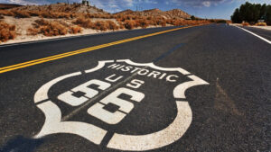


Driving Route 66 in 2025 means navigating a highway the federal government decommissioned in 1985. The interstate system gradually bypassed it over decades; by June of that year, the Mother Road was officially removed from the U.S. Highway System. What remains is a 2,199-mile patchwork of surviving diners, fading motels, and long stretches where dangerous states modern services simply don’t exist. Developer Jake Boyles decided that problem needed a real solution — not a romanticized travel blog — and built a Route 66 mode inside his app, Pit Stop: Road Trip Exit Guide. The timing is sharp: 2026 marks the highway’s 100th anniversary, established November 11, 1926.
The Scale of What Boyles Actually Built
Behind the scrollable interface is a dataset dense enough to matter on the road.
Where nostalgia stops, logistics begin. According to a Reddit post by Jake Boyles, the app catalogs roughly 2,400 places to eat, 1,300 motels, and coverage across 280 towns along the route. That density matters most in the dead zones — the long desert stretches through New Mexico and Arizona where the next gas station isn’t guaranteed. The app organizes stops by category — gas stations, food, and motels — with elevation changes mapped across the full scrollable corridor.
What the app includes at a glance:
- Scrollable 2,199-mile route with elevation data from Chicago to Santa Monica
- Approximately 2,400 food stops and 1,300 motels across 280 towns
- Searchable categories: gas stations, food, lodging
- Vehicle styling that nods to the highway’s golden era — a 1950s turquoise car and a white roadster reminiscent of the 1960s Route 66 TV show
- Centennial-ready framing built around the highway’s November 1926 founding
A Useful Tool With One Open Question
The practical case for this map is strong — one detail about how to access it remains unresolved.
Removed from the U.S. federal highway system in 1985 after decades of interstate bypass, Route 66 spans eight states in its historic alignment — roughly 2,448 miles total. The app’s 2,199-mile figure reflects the continuous driveable version Boyles mapped, as confirmed by Pit Stop and reporting from Route 66 News. It remains unclear, based on available reporting from The Drive and Boyles’ Reddit post, whether the Route 66 feature lives inside the existing Pit Stop app or functions as a standalone web tool.
What is not unclear is the utility. This is not a map built for armchair nostalgia. It is built for the person who actually wants to drive the thing without running out of gas somewhere past Albuquerque.
If you are plotting the centennial run in 2026, this is the kind of practical tool worth bookmarking early.